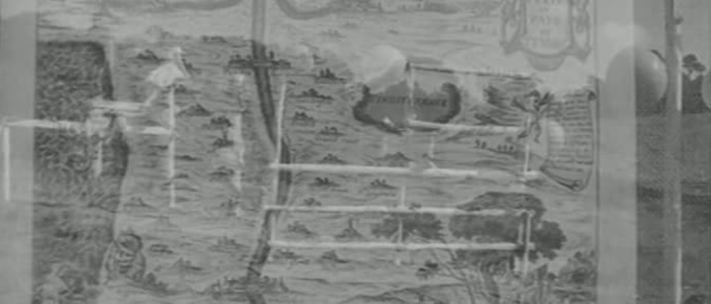
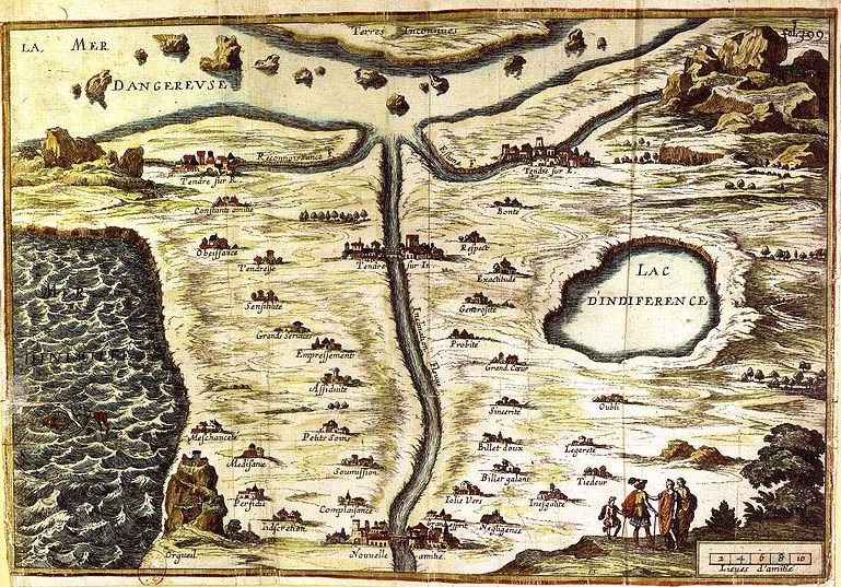
  The 'Carte du pays de Tendre' is a seventeenth-century French confection, an allegorical and topographical lover's guide. It acquired cinematic currency in the late '50s when it served as backdrop to the credits for Louis Malle's Les Amants, and carto-theoretical currency more recently when Malle's use of it was analysed by map readers Giuliana Bruno and Tom Conley (see here). 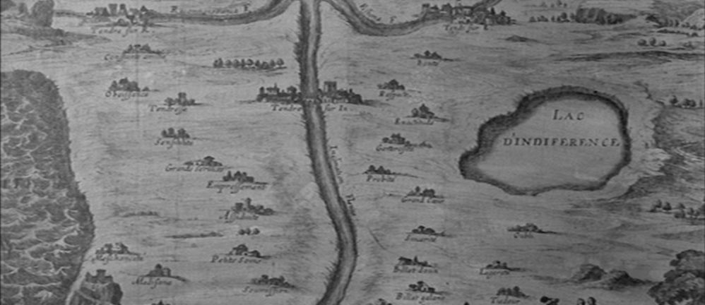 In Tire au flanc 62, a New Wave comedy about the life of conscripts, the protagonist is in love with the Colonel's daughter, and in his dreams reconfigures the assault course (which he had failed to negotiate earlier that day) into a Carte du pays de Tendre, with obstacles labelled in the manner of the seventeenth-century map: 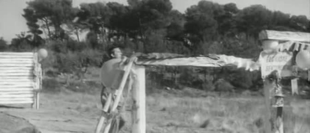 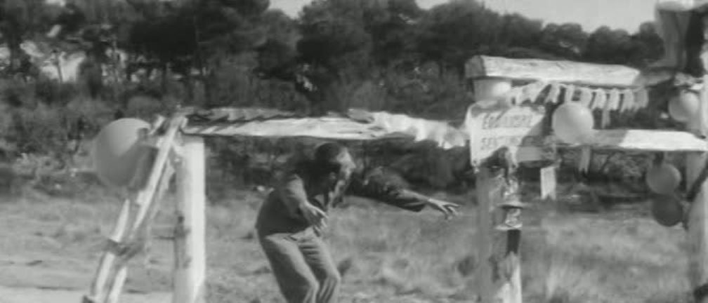 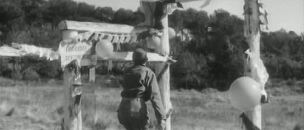 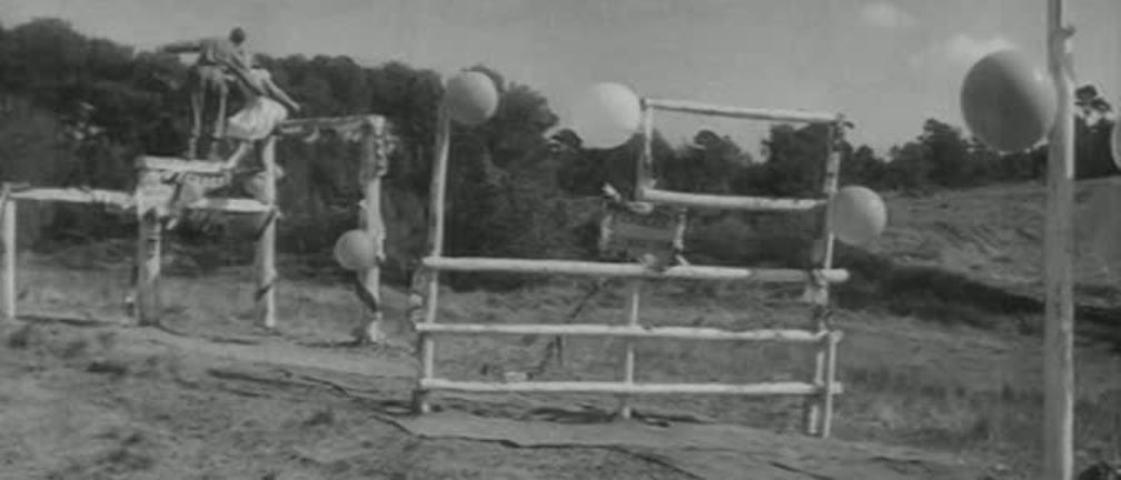 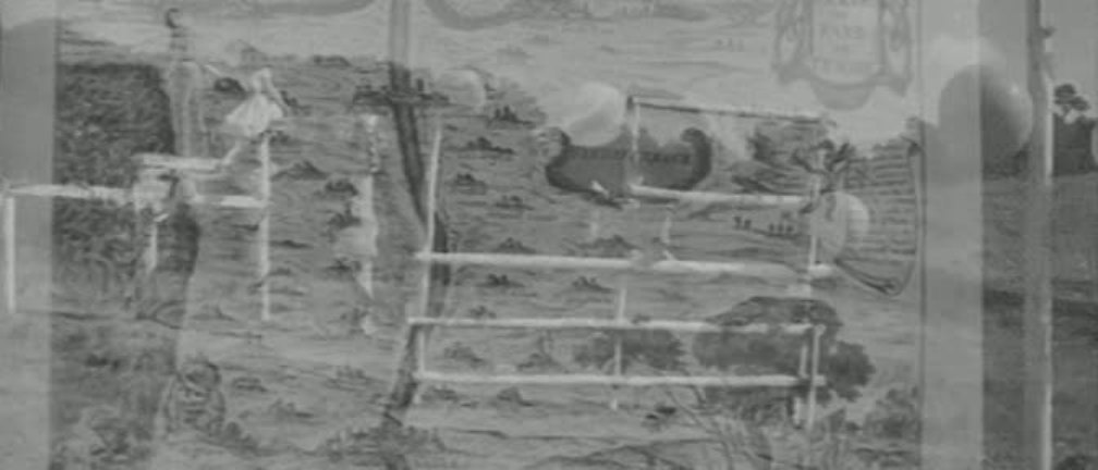 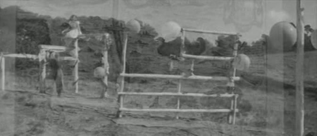 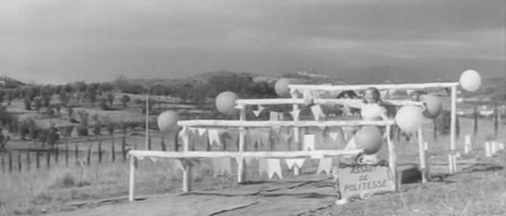  (He eventually wins through to the end of the course and finds true love, as you can see here.)
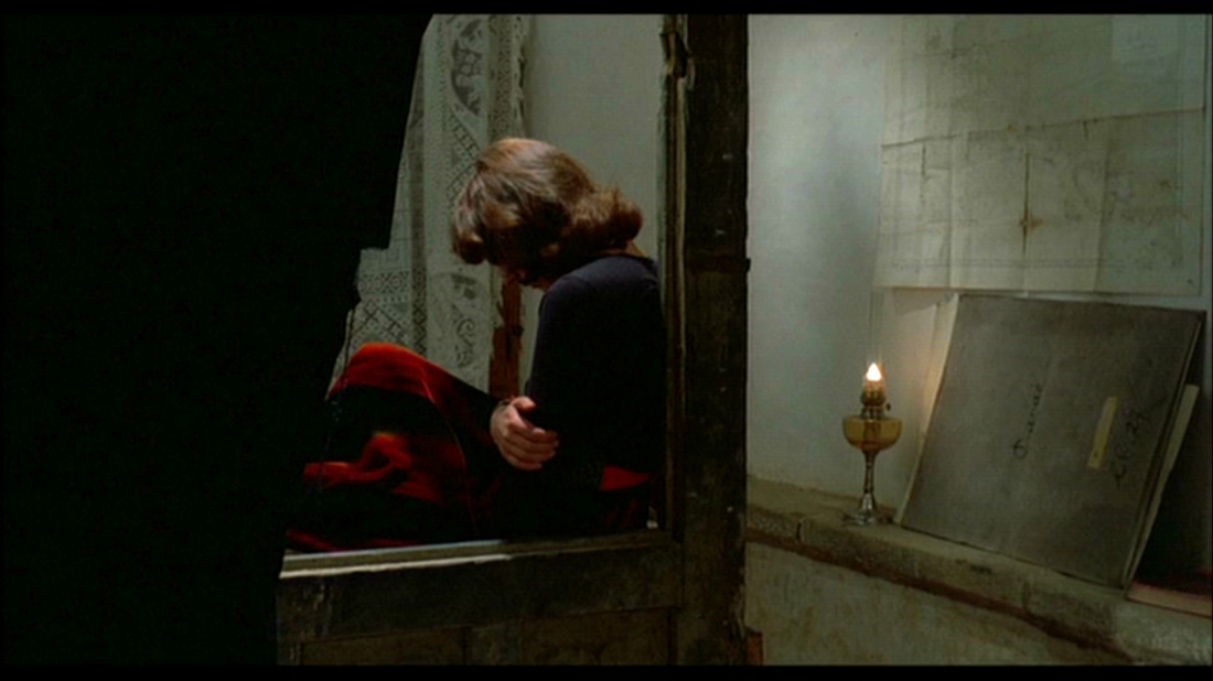 Of which place this is a map is far from being the most pressing question we might ask of Rivette's enigmatic film, but it still troubles the Cine-Tourist. Any suggestions welcome (here).  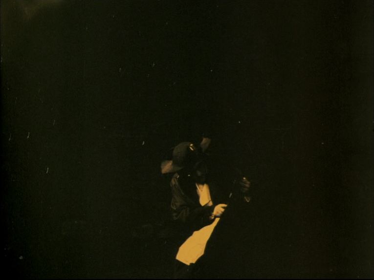 A plan to rescue Marie Antoinette from the guillotine involves tunnelling from a house on the rue de la Corderie into the Tour du Temple. This is an early example of a map scrutinised in detail (see here for others). The map itself, hand drawn, is relatively correct as regards layout and nomenclature (see, at the end of this post, the corresponding segment from a 1797 map). 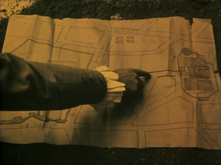 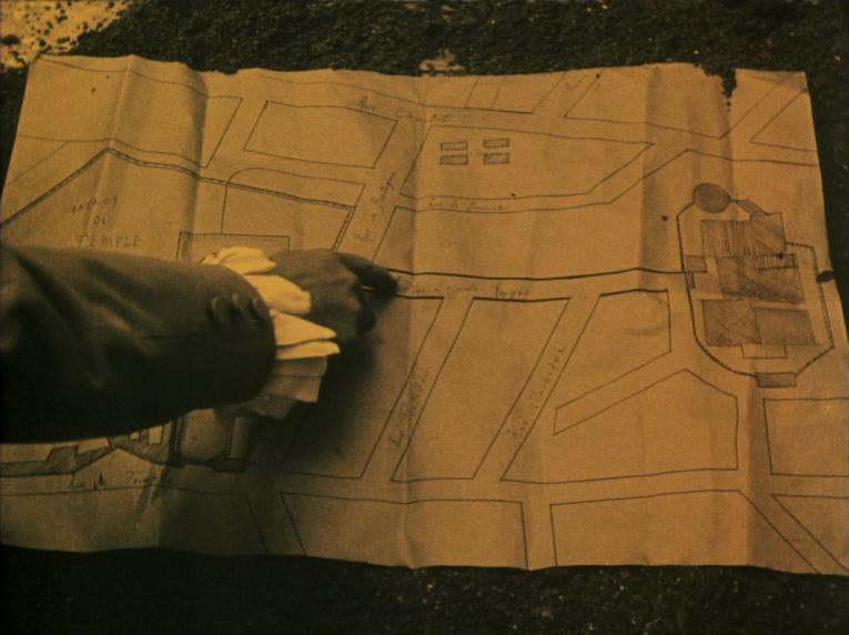 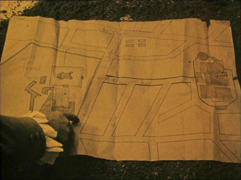    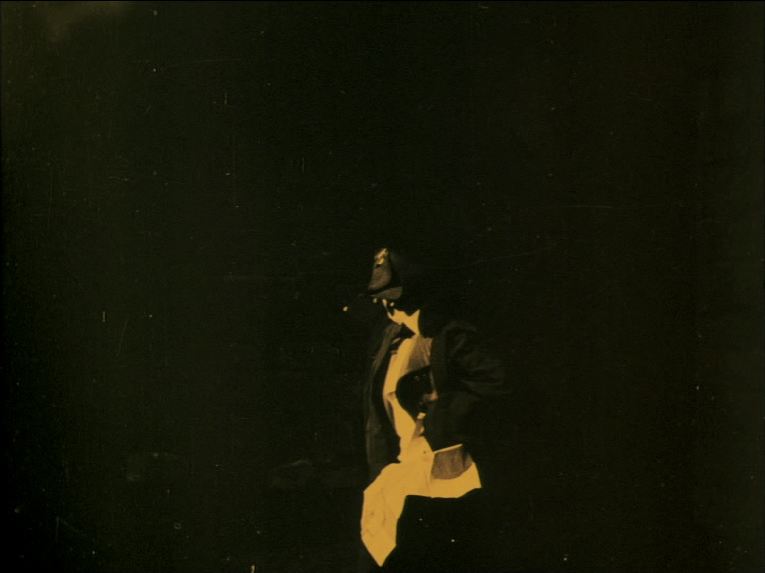 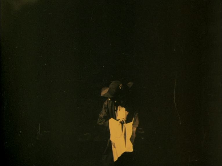 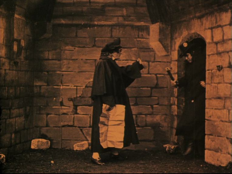 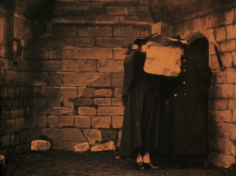 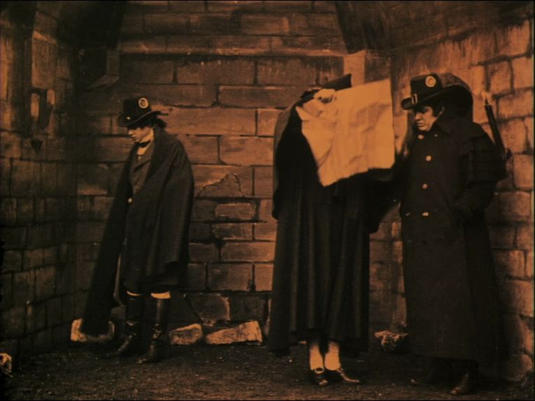 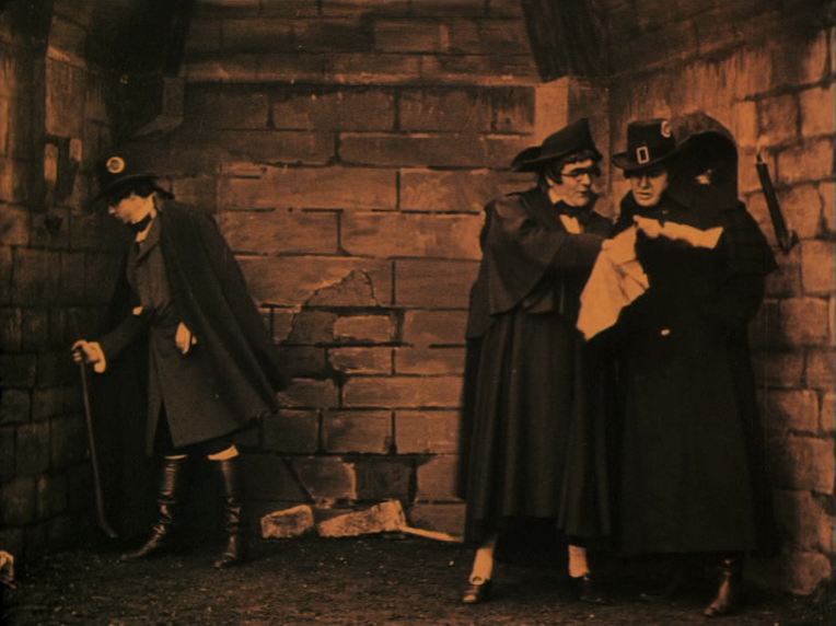 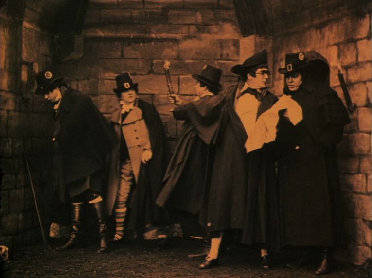 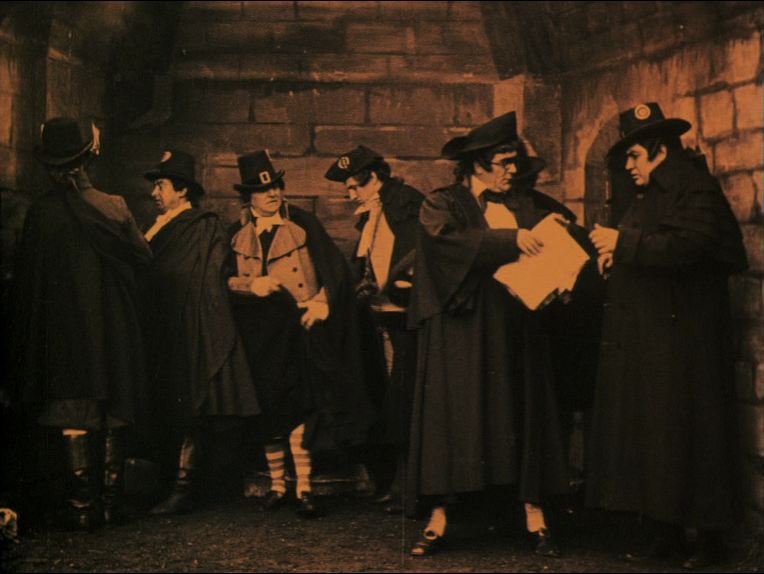 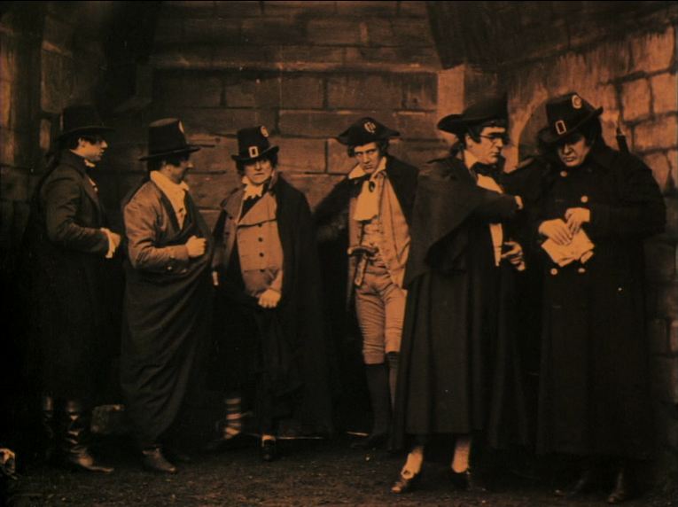 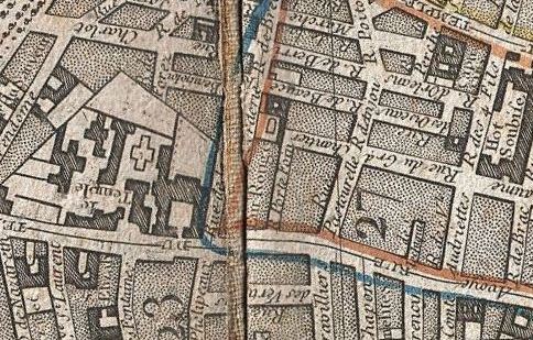 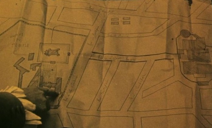  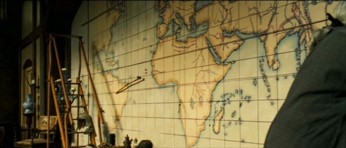   Heike Steinhoff, Queer Buccaneers: (De)Constructing Boundaries in the Pirates of the Caribbean Film Series (Berlin: Lit Verlag, 2011), p.116. 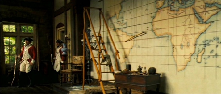 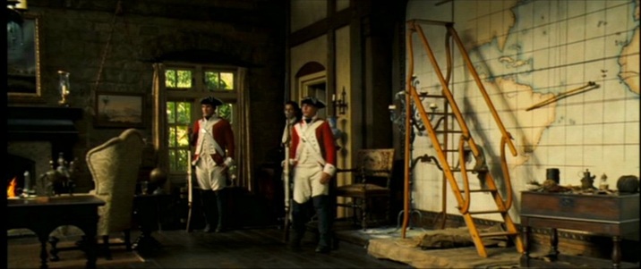 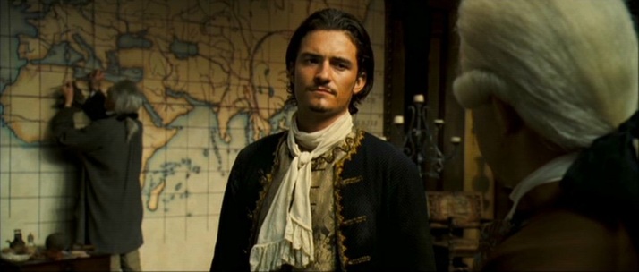 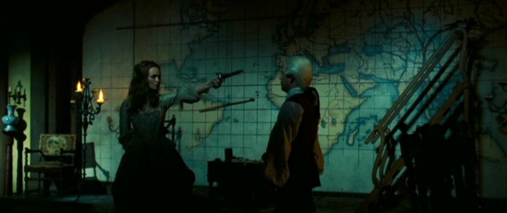 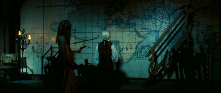 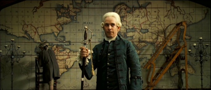    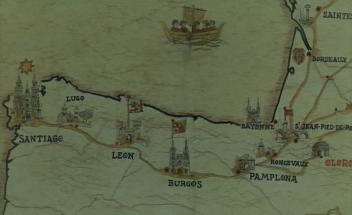 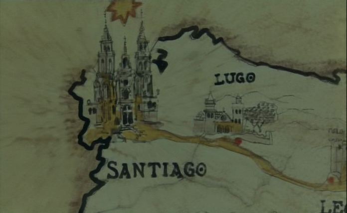 ‘From childhood holidays at Santander and San Sebastian, Bunuel remembered the tradition of a pilgrimage to the shrine of St James of Compostela at Santiago in the same far northwestern corner of Spain, only 50 kilometres from the Atlantic. The route from northern Europe was known as the Milky Way, because in ad 813 a hermit was supposed to have . followed that field of stars (campus Stellas) to the body of St James (Santiago in Spanish), hidden there for centuries.’
John Baxter, Buñuel (London: Fourth Estate, 1995), p.288.  David Bordwell has read in detail the first map scene in There Will Be Blood (here), analysing the simple but powerful staging of this one-shot sequence: 'Many directors would have cut in to a close-up of the map, showing us the details of the layout, but that isn't important for what Anderson is interested in. The actual geography of Plainview's territorial imperative isn't explored much in the movie, which is more centrally about physical effort and commercial stratagems.' There are three more map scenes in the film, each of them as indifferent to the actual geography of that part of California, because Anderson isn't interested in the details of the layout, of course, but also because these would be real maps on which the fictional 'Little Boston, Isabella County' couldn't appear. The next map scene is Plainview's visit to a real estate office, a two-shot sequence in which there are three maps on the wall, differentiated in look but hardly readable in detail. A fourth map is brought out after Plainview asks Al Rose the pertinent question: 'Well, where's the map?'  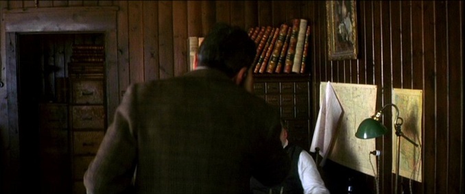 This map is discussed in detail, but no portion of it is shown: 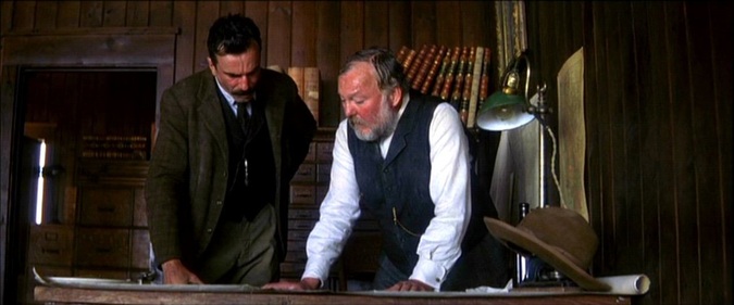 This scene is followed up later in a one-shot sequence where Plainview discusses the same area with Rose. This time the camera moves slowly in towards a closer framing of the table on which the map is placed. The map is distinctively coloured but still not readable: 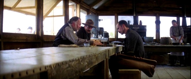 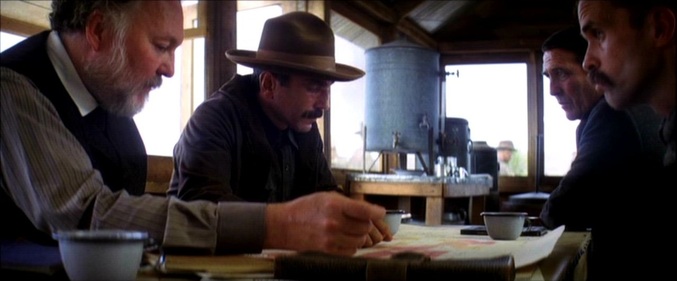 At the end of this shot the map is rolled up. Two earlier views of a rolled-up map, in Plainview's site office, serve as reminders of the territorial imperative, but also that we are not fixed on the actual territory: 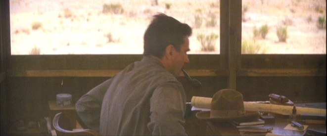 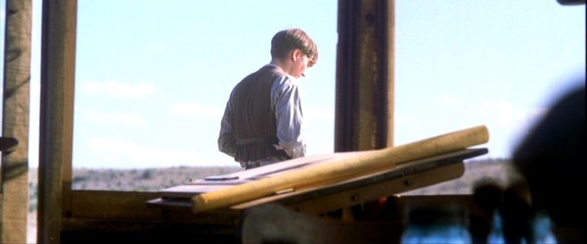 The last map scene offers a satisfying match of territory and map, not through actual geography, but in the repetition over a map of a gesture performed in the territory. First a wooden stake is hammered into the ground, signalling the route for the pipeline: 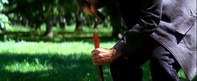 And then, at a meeting with his Union Oil associates, Plainview hammers a stake into the map, through the map and into the table on which it is spread: 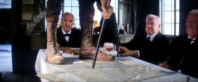 The film will run for another fifty minutes without being interested in maps again. A short dvd-bonus on the research that went into the film shows two maps consulted, and a period photograph of maps being used:    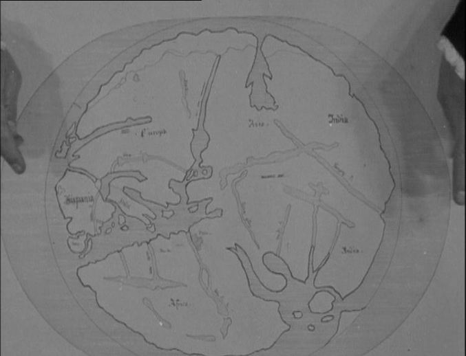 The model for the map used here appears to be this, a nineteenth-century configuration of a fifteenth-century map: 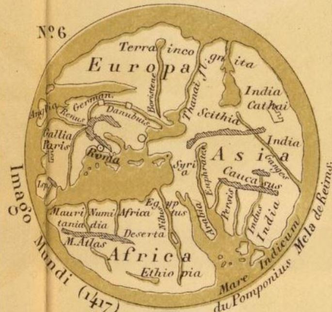  This is an 1874 Hachette publication. The map is based on an illustrated initial (the O of Orbis) in a 1417 manuscript of Pomponius Mela: 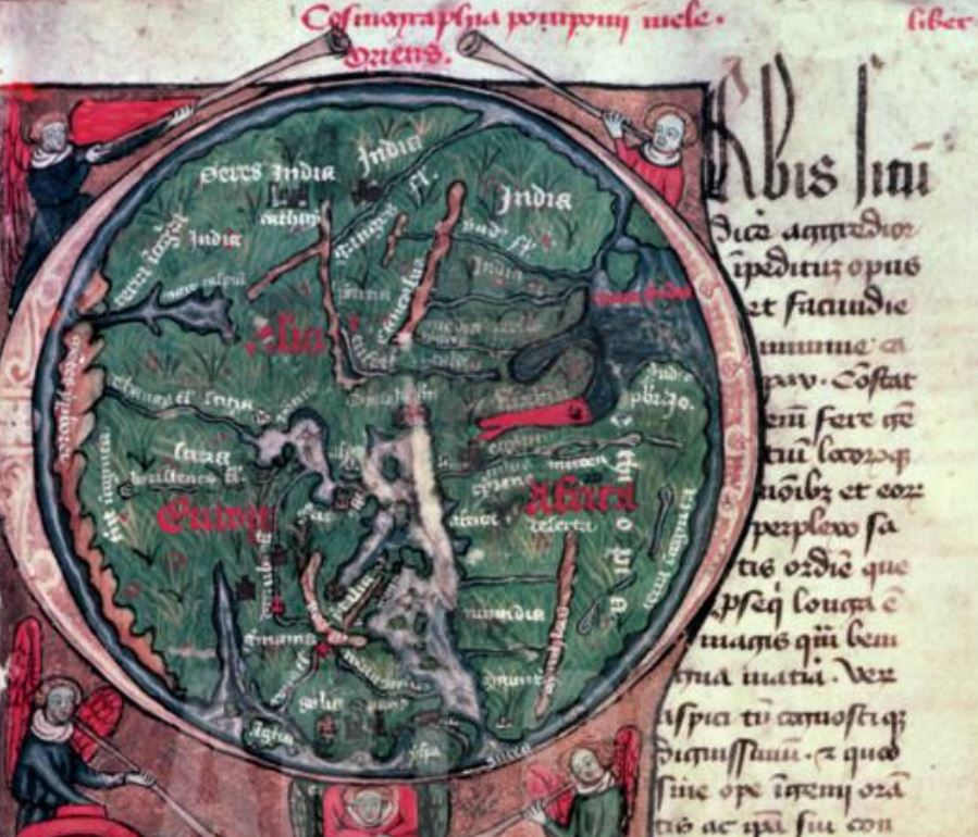 The scene in Christophe Colomb is the earliest instance I know where a map is discussed, pointed at and made available to be read by the spectator. Richard Abel (who attributes this film to Louis Feuillade, though a recent Gaumont edition gives it to Etienne Arnaud) signals the unusualness of the shot: ‘The first scene, in which Columbus explains his plan to the Genoa officials, is filmed in full shot, but includes a cut-in to an unusual high angle close up of a map (approximating a POV shot), with his hands coming in from the top of the frame to point and gesture.’ See Richard Abel, The Ciné Goes To Town: French Cinema 1896-1914 (Berkeley CA: University of California Press, 1994), p.273. 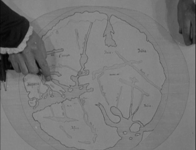 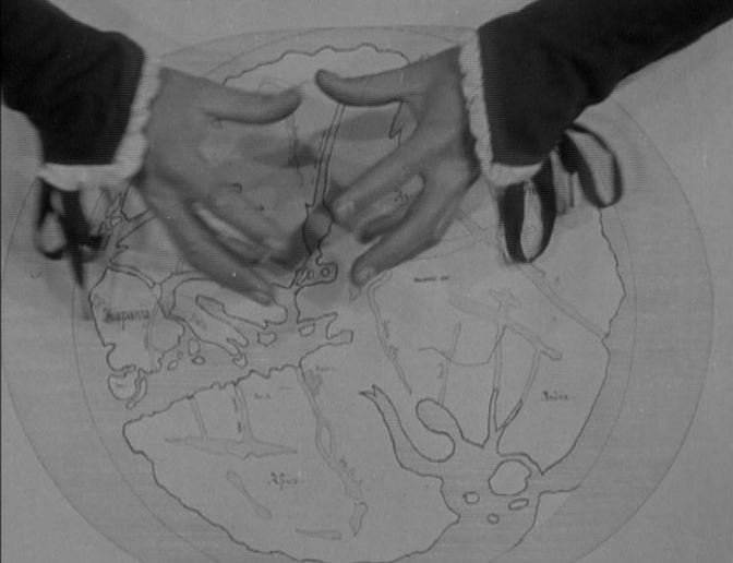 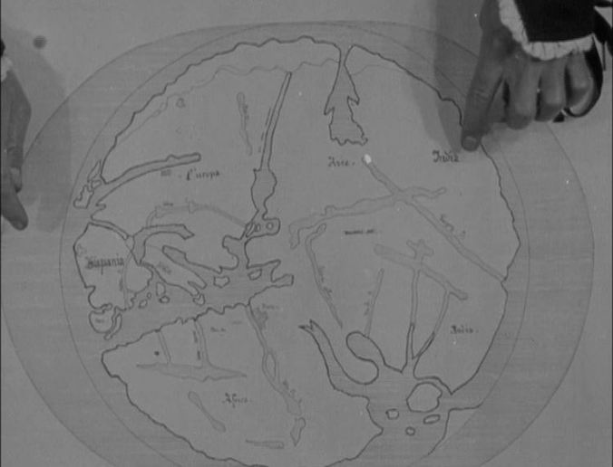 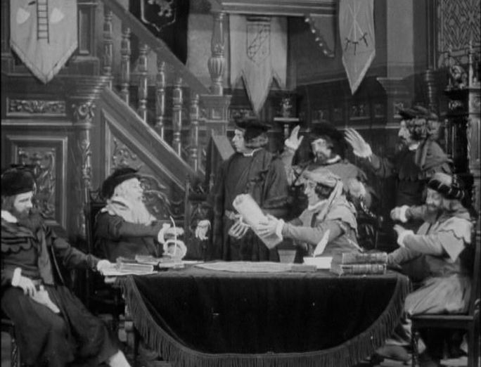 Columbus can be seen clinging determinedly to his map in four further scenes of the film:   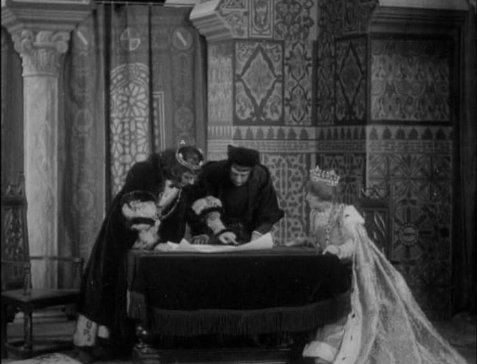   ‘Cartographic imaginings not only locate us on this earth but also help us invent our personal and social identities, since maps embody our social order. Like the movies, maps helped create our national identity.’ Vincent Virga, Texas: Mapping the Lone Star State Through History: Rare and Unusual Maps from the Library of Congress (Guilford CT: Morris, 2010), p. vi.  No Country For Old Men (Ethan & Joel Coen 2007)  Loving You (Hal Kanter 1957)  Loving You (Hal Kanter 1957) 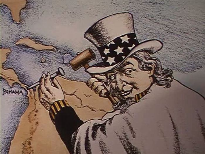  ‘England supports Chile's independence. Isabel II of Spain has the city bombarded. The final shudder of the thwarted coloniser. In its turn the ground opens up. Earthquakes, floods, fires, cyclones and looting. This was to be the fate of this peace-loving people. And it did not end there. A cartoon satirising "Uncle Sam", driving a nail into Panama.. A mermaid watches over a ship. A bunch of seaweed, conjuring up streaming hair, floats in the troughs of the waves. Then different statues of mermaids. But when is there an end? The mermaids in the harbour have not ended their song. They are there, watching, listening, waiting.' Chris Marker, script for ... A Valparaiso, in Rosalind Delmar, Joris Ivens: 50 years of filmmaking (London: BFI, 1979), p.96.    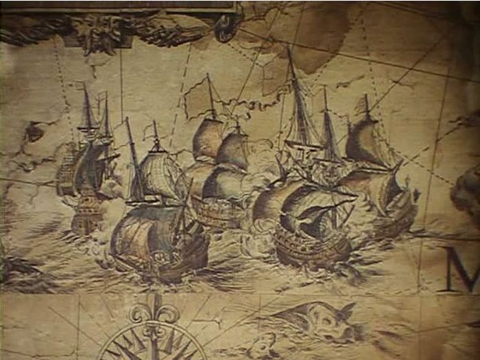 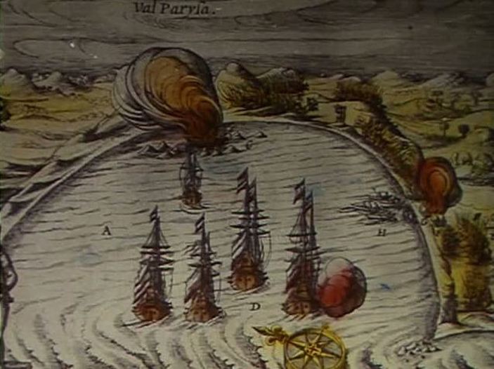  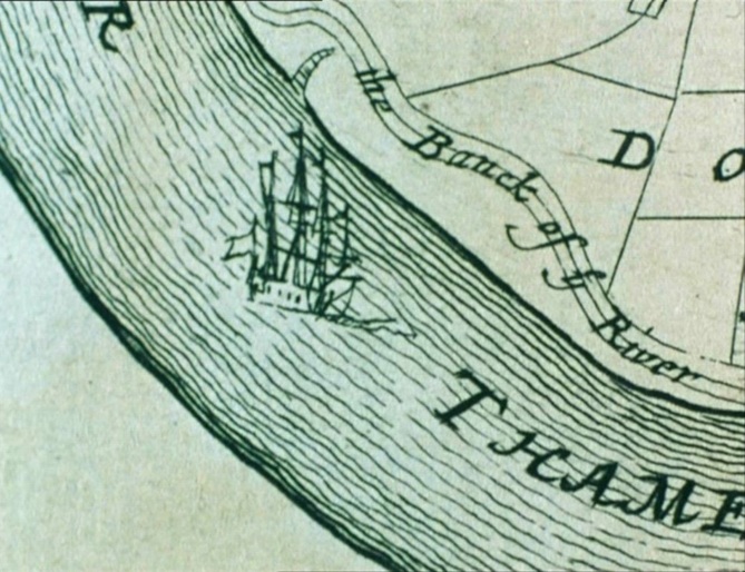 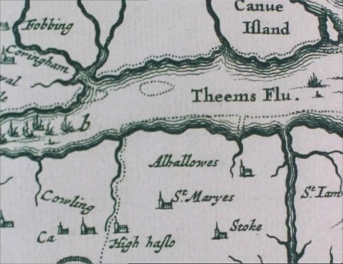 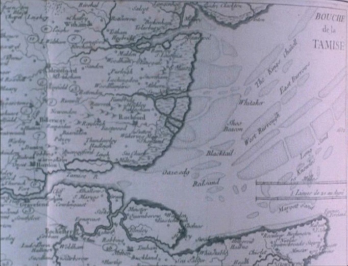 ‘His research into the historical and economic development of the river led him to the conclusion that his film needed to capture the “interpenetration of the natural and the fabricated”. This led to an obsessive fascination with maps and charts of the Thames. “I realize that this is because the topography of subject is most crucial. The river is the penetration of one element by another. They are equally interdependent upon each other for the river's existence”. A study of the conditions and topography of a river is actually a study of time and change, for any river has its own pace in nature. “I want to make a film that is an observation of the River Thames. It will be a landscape film, a documentary film and a film about a journey…”.’
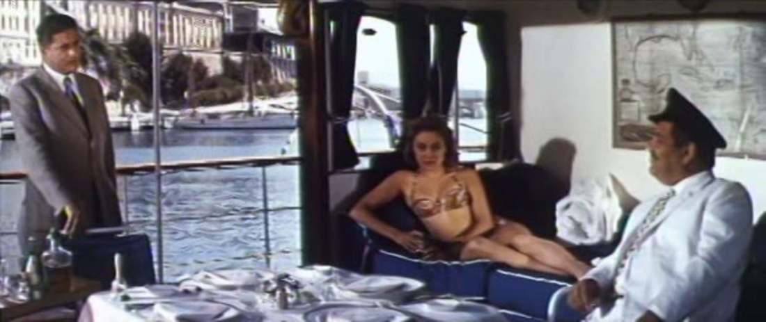
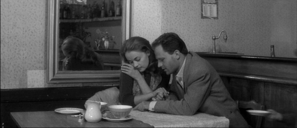
Jane Chapman, ‘William Raban: Thames Film’, in Documentary in Practice: Filmmakers and Production Choices (Malden MA: Polity Press, 2007), p.59. The credits open by panning up the map, showing firstly only the Lake of Indifference but revealing the word 'dangereuse' as the name of Jeanne Moreau appears:  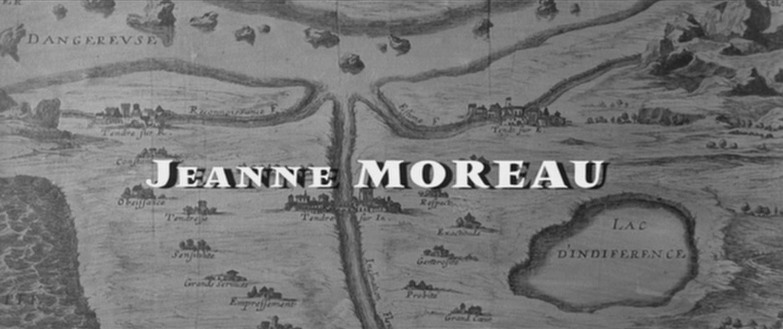 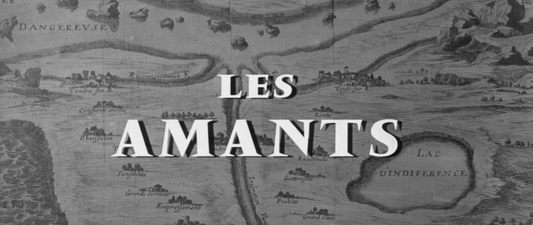 This map is a reference point for occasional map-reader Giuliana Bruno: ‘She inscribed a journey on her map of home, using a form of cartographic representation that goes all the way back to Madeleine de Scudery's Carte du pays de Tendre (1654), a map that visualized, in the form of landscape, a world of affects. An emotional journey is drawn in these maps of lived space. They show the motion of emotions that reside in-house. In this affective mapping drawn by women home can indeed turn into a voyage.’ Giuliana Bruno, Public Intimacy: Architecture and the Visual Arts (Cambridge MA: MIT Press, 2007), p.165. Bruno reads the use of this map in Les Amants in Atlas of Emotions, p. 241. See also Tom Conley, 'Michelin Tendre', in Cartographic Cinema, pp. 127ff, and T. Jefferson Kline, 'Cinema and/as Mapping', in Unravelling French Cinema, pp. 89ff. The other map in Les Amants is a map of France. The Scudéry map also appears in Givray and Truffaut's Tire au flanc '62 (1960). 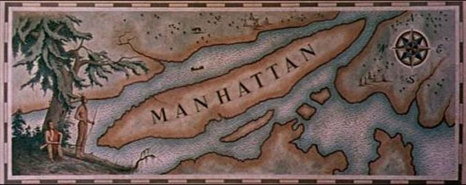 'A friend tells me: ''It's unhealthy to think of the past as real or true. The human being, he says, undergoes a complete transformation every seven years.'' Still, events remain, even if the Hotel has disappeared or the Hospital was nothing but a make- believe-Hospital everything has occurred for eternity in the imagination which unfolds its map of yesterday, its American Map, in the ill-defined vicinity of my today-reality. There are hundreds of important changes you need to know about today tells yesterday, but in the meantime today is already yesterday. New York has changed a lot. New York never changes. New York is a in perpetual state of a-changing. “Every day, road construction crews, State and Federal transportation authorities and local developers are working to make your maps and atlases out of date,'' American Map states. Only in American could you make such an apocalyptic statement.'
Hélène Cixous, ‘I Will Not Write This Book’, in Manhattan: Letters from Prehistory (New York: Fordham University Press, 2007), pp.49-50. See also: (e)space & fiction 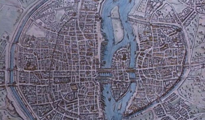 'Placing a literary phenomenon in its specific space - mapping it - is not the conclusion of geographical work; it's the beginning. After which begins in fact the most challenging part of the whole enterprise: one looks at the map, and thinks. You look at a specific configuration - those roads that run towards Toledo and Sevilla; those mountains, such a long way from London ; those men and women that live on opposite banks of the Seine - you look at these patterns, and try to understand how it is that ail this gives rise to a story, a plot.'
Franco Moretti, Atlas of the European Novel, 1800-1900 (London: Verso, 1998) 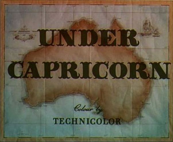 'In thus projecting Australia as an unsettled “dark continent,” the map exposes a contradiction on which colonial discourse is predicated, which it is typically at pains to conceal. The map erases any signs of aboriginal habitation and signifies "Australia" as an open, unmarked, unoccupied territory, standing in presumed readiness to be colonized, but it also reveals that the boundaries of the colonial enterprise are not timelessfrontiers that have always really been there, waiting to be fulfilled by the manifest destinies of dominion and the progressive ideals of history itself. Rather, they are revealed as constructed territories, lines on a map, to be drawn by the violent interventions of colonial power.
Unlike the map of Casablanca, the map of Under Capricorn foregrounds its status as a "sign." It is quite obviously a page in a book, as evidenced by an unhidden wrinkle running through it and a printed page-border enclosing it. By contrast to the pristine graphic emblem of Casablanca, that of Under Capricorn presents itself not as an incorporeal symbol, free of material, worldly influences, but as a mundane object, rife with them; and the insistent artifice of the first shots of Australia realizes the anti-illusionist impulse of the presentation of the map.' James Morrison, 'Hitchcock's Ireland: the performance of Irish identity in Juno and the Paycock and Under Capricorn', in Richard Allen & Sam Ishii-Gonzalez (eds), Hitchcock Past and Future (London: Routledge, 2004), p.201. |
